BMKG Warns Potential Extreme Weather During Christmas, New Year

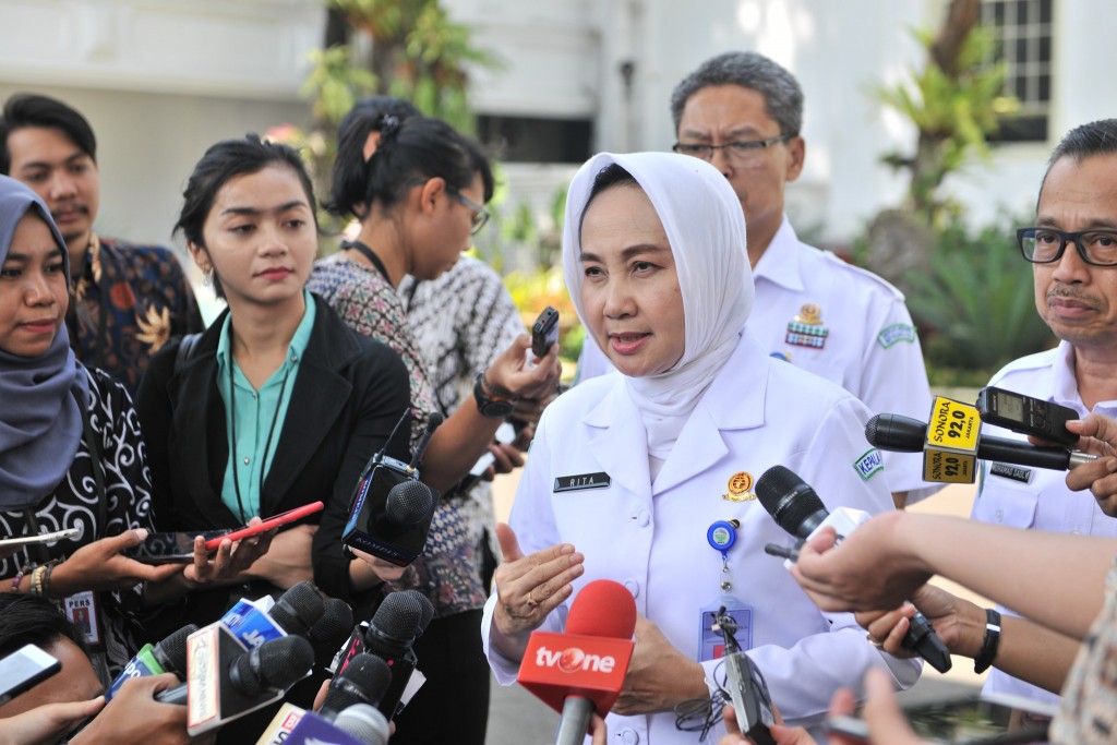
Head of BMKG Dwikorita Karnawati (Photo: Jay/PR)
Head of the Meteorology, Climatology and Geophysics Agency (BMKG) Dwikorita Karnawati has announced there will be an increase in rainfall in a number of regions in Indonesia next week, especially during the upcoming Christmas and New Year holidays.
Based on the BMKG Impact-Based Forecasting information platform, Dwikorita said several areas with potential alerts in the period December 21 to 23, 2022 are parts of Aceh, parts of North Sumatra province, parts of Riau province, parts of West Java province, parts of Central Java province, parts of East Java province, parts of East Nusa Tenggara province, parts of West Kalimantan province, parts of East Kalimantan province, parts of North Kalimantan province, parts of Maluku province, and parts of Papua province.
“Especially for December 24, 2022, potential alerts may be in place for parts of Central Java, East Java, South Sulawesi provinces,” she said, Tuesday (12/20).
Dwikorita went on to say that the potential for rain with significant intensity during the period of December 25, 2022 to January 1, 2023 may happen in several areas.
In the meantime, heavy to very heavy rains are likely to occur in provinces of Banten, West Java, Central Java, Yogyakarta, East Java, Bali, West Nusa Tenggara, East Nusa Tenggara, South Sulawesi, Southeast Sulawesi and Maluku, while moderate to heavy rain is likely to occur in provinces of Aceh, Lampung, South Sumatra, Jakarta, Central Kalimantan, South Kalimantan, North Maluku, West Papua and Papua.
She also warned of the potential for high waves in Indonesian waters from December 23 to 27, 2022 which needs to be vigilant against.
“The 4.0 to 6.0 meter wave height category is in the Indian Ocean in south of Banten, the Indian Ocean in south of West Java, the Indian Ocean in south of Central Java, the Indian Ocean in south of East Java, the Indian Ocean in south of Bali, the North Natuna Sea, and the southern part of the Makassar Strait,” he said.
Moreover, a wave height category of 2.5 to 4.0 meters are likely to occur in Aceh waters, Natuna Sea, Karimata Strait, Java Sea, Bali Sea, Sumbawa Sea, Flores Sea, Sunda Strait, Banten southern waters, Southern Java waters, southern Bali, Lombok southern waters, Sumbawa southern waters, Sumba island waters, South Sulawesi western waters, northern part of the Makassar Strait, Halmahera waters, western part of the Arafuru Sea, southern Indian Ocean of West Nusa Tenggara, and southern Indian Ocean of East Nusa Tenggara.
“Those who travel by sea transportation needs to heighten their vigilance as an effort to adapt and mitigate these conditions,” she said.
In addition, Dwikorita also asked the public to continue monitoring information on weather developments and extreme weather early warnings from the BMKG in more detail for each sub-district in all parts of Indonesia.
The information can be accessed through the BMKG website for weather forecasts to the sub-district level, the agency’s social media account @infobmkg, mobile-based applications Info BMKG on iOS and android, as well as the 196 BMKG call center.
“Or you can directly contact the nearest BMKG office,” she remarked. (UN) (EST/EP)


