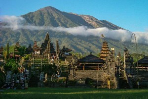
Resort Island of Bali Remains Safe for Tourists to Visit
 Head of Center for Volcanology and Geological Disaster Mitigation (PVMBG), Geological Agency of the Ministry of Energy and Mineral Resources, Kasbani, said that until now Bali is still safe for tourists to visit. However, tourists should not enter the no-go zone near Mount Agung (currently within a radius of 9 km and an extended area as far as 12 km from the peak to the Southeast, South, and Southwest as well as to the North up to Northeast).
“PVMBG continues to coordinate with the National Agency for Disaster Management (BNPB) to strengthen the early warning system of eruption. The tourists and the local community must continue to abide by the instructions set by the Government of Indonesia,” Kasbani said in a press release Friday (29/9) afternoon.
When it comes to the probability of eruption, Kasbani explained that the probability for the eruption of Mount Agung, which is located in Karangasem Regency, is still higher. However, the exact date and time of the eruption cannot be predicted. “PVMBG will issue a warning when circumstances change and/or if observed the eruption is imminent,” Kasbani firmly said.
According to Kasbani, volcanic activity on Mount Agung, which has been on the Alert Status since 22 September this year, is still very high. He mentioned that recently, earthquake has more often felt by people around Mount Agung and Mount Batur. Some of the biggest volcanic earthquakes can even be felt in the areas of Denpasar and Kuta. “The volcanic earthquake is estimated to be under the crater to a depth of 20 km from the peak of the volcano,” Kasbani explained.
Based on the calculation of the magnitude of the earthquake, Kasbani continued to explain, the scale continues to increase. The magnitude of the largest earthquake during this crisis period is the earthquake with magnitude of M4.3 on Wednesday (27/9) at around 1:12 pm Central Indonesian Time.
Meanwhile, based on remote sensing of satellites, the emission of white smoke (steam) and a new hot area in the peak crater of Mount Agung were spotted. Kasbani explained that the hot area is observed to have been enlarged over the past week, including a new fracture in the middle of the crater where the emission of white smoke is also continuing. “The emission of white smoke (steam) from the crater is generally observed with an average height of 50-200m above the peak. Currently, the emission of smoke (steam) is observed relatively more continuously,” Kasbani said.
After an earthquake with magnitude of M4.2 that occurred on Tuesday (26/9) at 4:27 pm Central Indonesian Time, Kasbani said that white smoke (steam) came out with a greater intensity and was spotted to a height of about 500 m above the peak. “Analysis of tiltmeter data indicates the inflation (swelling) on ??the body of Mount Agung,” Kasbani explained.
Looking at the circumstance of the latest monitoring data, Kasbani explained that the probability of eruption is still higher than the probability of not erupting. However, the probability of an eruption may change at any time depending on the current monitoring data. (Bureau of Information and Public Relations, MEMR) (MUR/YM/Naster).


